Source: ALJAZEERA
ALJAZEERA MEDIA NETWORK

Explore the historical and ongoing land seizures by Israel in Palestine, including the recent surge in annexations and settlements.
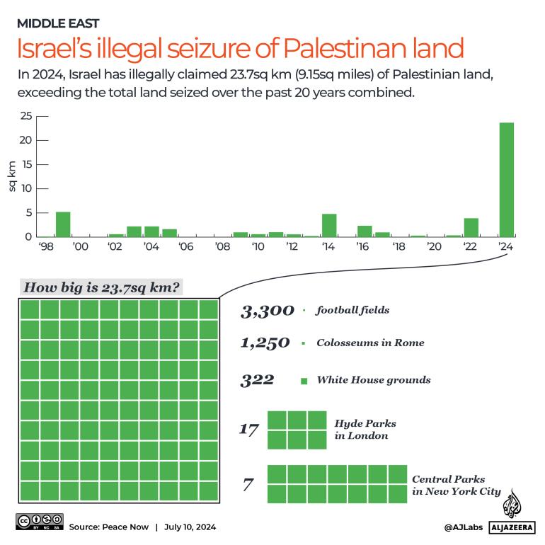
In 2024, Israel unlawfully seized 23.7sq km (9.15 sq miles) of Palestinian land in the occupied West Bank, amid conflicts in Gaza.
This amount exceeds the total land annexed in the past two decades.
 INTERACTIVE - Israel Palestine land seizure-1720674778
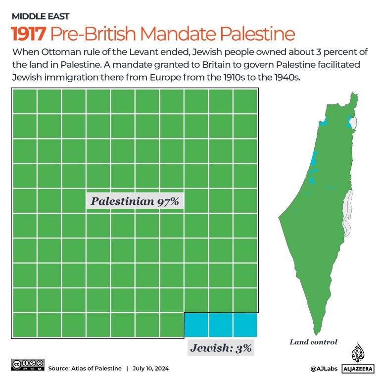
Following the end of Ottoman rule in the Levant, Jewish ownership of Palestinian land stood at approximately 3 percent.
During World War I, Britain secured support from various Middle Eastern groups, marked by the significant 1917 Balfour Declaration advocating a "national home for the Jewish people" in Palestine.
Post-war, Jewish immigration from Europe increased, boosting the Jewish population in Palestine to 33 percent by 1947.
Historical Palestine spanned 26,790sq km, similar in size to Haiti (27,750sq km).
 INTERACTIVE - Israel Palestine land pre-british mandata 1917-1720674792
In 1948, with the end of the British Mandate, Zionist leaders announced the establishment of a state, triggering the first Arab-Israeli conflict.
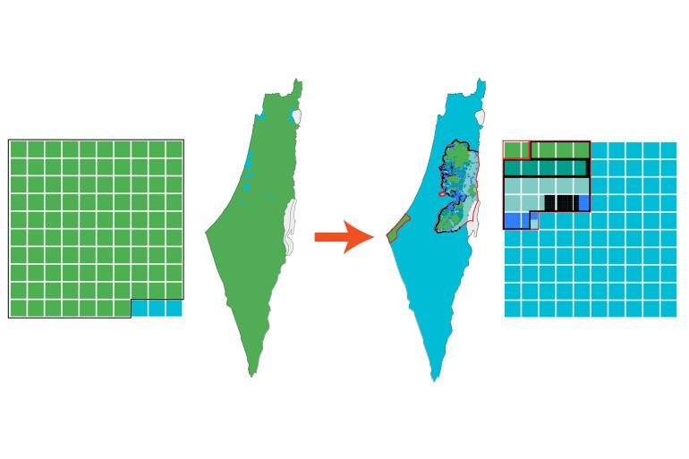
Subsequently, Zionist forces expelled around 750,000 Palestinians, claiming 78 percent of the land. The remnant 22 percent was divided into the Gaza Strip and the West Bank.
The West Bank, located west of the Jordan River, covers 5,655sq km, substantially larger than the 365sq km Gaza Strip neighboring Egypt.
Following the 1967 war, Israel occupied all of historical Palestine, including Gaza, West Bank, East Jerusalem, the Syrian Golan Heights, and Egypt's Sinai Peninsula.
Israel initiated settlements in the occupied territories after the war, breaching the Fourth Geneva Convention prohibiting population transfers by occupying forces.
East Jerusalem, situated on the Palestinian side of the Green Line, covers roughly 70sq km and encompasses religious sites sacred to Christianity, Islam, and Judaism.
In 1980, Israel declared Jerusalem as its unified capital, leading to disapproval from the UN Security Council and intensified hardships for Palestinians living in the region.
The Oslo Accords resulted in the creation of the Palestinian Authority (PA) for governing internal affairs in designated self-rule areas during a temporary period.
Under the Oslo agreements, the West Bank was segmented into three sectors: Area A, Area B, and Area C.
Israel commenced constructing a security barrier in 2002, slicing through the West Bank for over 700km, hampering movement and separating families.
The extensive wall, claiming security purposes, infringes on West Bank territory, disregarding the established Green Line.
Current data shows about 700,000 settlers residing in 300 unauthorized establishments in the West Bank and East Jerusalem.
Ongoing government actions and settlements continue to impede the Palestinian right to self-determination.
Your email address will not be published. Required fields are marked *